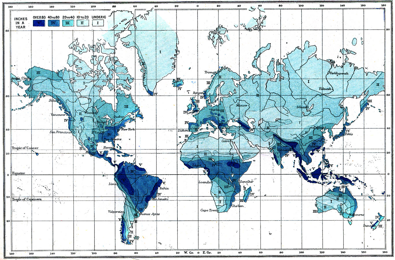
Description: A World map from 1904 showing the averaged rainfall distribution measured in inches per year, ranging from under 10 inches to over 80 inches.
Place Names: A Complete Map of Globes and Multi-continent, Africa, �Asia, �Australia, �Europe, �North America, �South America, �Sitka, �Vancouver, �San Francisco, �New York, �New Orleans, �Havana, �Lima, �Bahia, �Valparaiso, �Rio Janeiro, �Buenos Ayres, �Tromso, �Bergen, �London, �Moscow, �Lisbon, �Cairo, �Lag
ISO Topic Categories: climatologyMeteorologyAtmosphere,
inlandWaters,
oceans
Keywords: The World: Rainfall, physical, �meteorological, physical features, rainfall, climatologyMeteorologyAtmosphere,
inlandWaters,
oceans, Unknown, 1904
Source: Geo. G. Chisholm and C.H. Leete, eds., Longmans' New School Atlas (New York, NY: Longmans, Green, and Co., 1904) 6
Map Credit: Courtesy the private collection of Roy Winkelman |
|