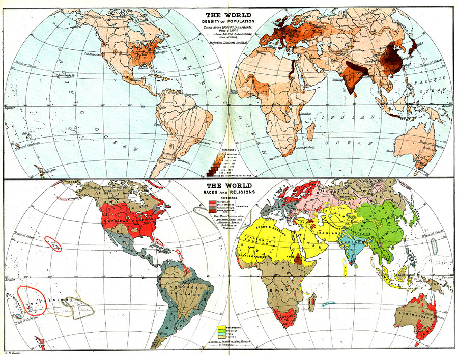
Description: Two world maps showing population density, races and religions current to 1900.
Place Names: A Complete Map of Globes and Multi-continent, Africa, �Asia, �Australia, �Europe, �North America, �Pacific Ocean, �Atlantic Ocean, �South America,
ISO Topic Categories: inlandWaters,
oceans,
society
Keywords: The World: Density of Population; Races and Religions, physical, �statistical, �Lambert's Zenithal, physical features, population,
ethnological, inlandWaters,
oceans,
society, Other, 1904
Source: Geo. G. Chisholm and C.H. Leete, eds., Longmans' New School Atlas (New York, NY: Longmans, Green, and Co., 1904) 8
Map Credit: Courtesy the private collection of Roy Winkelman |
|