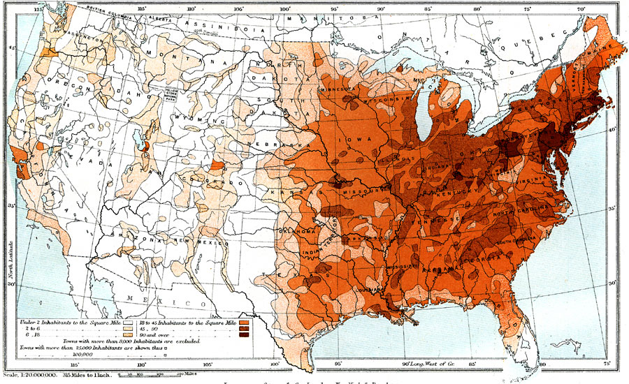
Description: A map from 1904 of the United States, showing the averaged population density per square mile based on the census of 1900, ranging from under 2 inhabitants to the square mile to over 90 inhabitants to the square mile.
Place Names: Demographics, Boston, �Chicago, �Houston, �Los Angeles, �Miami, �New Orleans, �New York, �San Diego, �Seattle, �Washington D.C., �populatio
ISO Topic Categories: boundaries,
inlandWaters,
oceans,
society
Keywords: The United States: Density of Population, physical, �political, �statistical, kPopulation, physical features, country borders,
major political subdivisions, population, boundaries,
inlandWaters,
oceans,
society, Unknown, 1904
Source: Geo. G. Chisholm and C.H. Leete, eds., Longmans' New School Atlas (New York, NY: Longmans, Green, and Co., 1904) 16
Map Credit: Courtesy the private collection of Roy Winkelman |
|