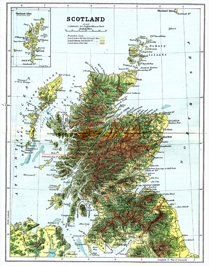
Description: A geo–political map of Scotland that shows district borders current to 1904, major cities, railroad lines, canals and navigable rivers. Hadrian's Wall is shown, referred to on the map as the Roman Wall. Physical features such as mountain ranges with elevation measured in feet, major rivers and watersheds, and the 100–fathom line in the off–shore waters is shown. Generalized elevations shown as land below 500 feet colored light green, land between 500 and 1,000 feet in elevation colored dark green, and land above 1,000 feet in elevation colored brown.
Place Names: United Kingdom, Edinborough, �Glasgow, �Inverness, �Aberdeen, �Firth of Fourth, �Loch Ness, �Ben Nevis,
ISO Topic Categories: boundaries,
elevation,
inlandWaters,
oceans,
transportation
Keywords: Scotland, physical, �political, �transportation, physical features,
topographical, country borders,
county borders, water routes,
railroads, boundaries,
elevation,
inlandWaters,
oceans,
transportation, Unknown, 1904
Source: Geo. G. Chisholm and C.H. Leete, eds., Longmans' New School Atlas (New York, NY: Longmans, Green, and Co., 1904) 21
Map Credit: Courtesy the private collection of Roy Winkelman |
|