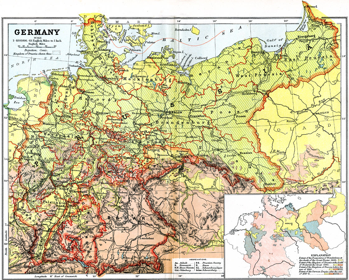
Description: A geo–political map of the Germany showing country and state borders current to 1904, major cities, railroad lines, canals and navigable rivers. Physical features include mountain ranges with elevation measured in feet, major rivers and watersheds. Generalized elevations shown as land below sea level feet colored dark green, land below 1,000 feet colored light green, and land above 1,000 feet in elevation colored brown. The Kingdom of Prussia is highlighted on main map, and an inset map showing the extent of the Possessions of Brandenburg at the death of the Great Elector (1688), extent of the Kingdom of Prussia at the death of Frederick the Great (1786), extent of the Kingdom of Prussia before the war of 1866, and the extent of the German Empire after the war of 1870–71.
Place Names: Germany, Berlin, �Bremen, �Cologne, �Dresden, �Frankfurt am Main, �Prussia, ��Hamburg, �Hannover, �Mannheim, �Nuremberg, �Wiesbade
ISO Topic Categories: boundaries,
inlandWaters,
oceans,
transportation
Keywords: Germany, physical, �political, �transportation, �Conic Projection, physical features,
topographical, country borders,
major political subdivisions,
local jurisdictions, railroads,
water routes, boundaries,
inlandWaters,
oceans,
transportation, Other, 1904
Source: Geo. G. Chisholm and C.H. Leete, eds., Longmans' New School Atlas (New York, NY: Longmans, Green, and Co., 1904) 26
Map Credit: Courtesy the private collection of Roy Winkelman |
|