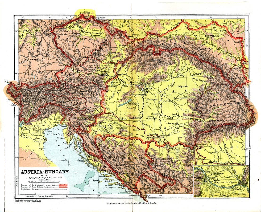
Description: A geo–political map from 1904 of Austria–Hungary showing country and province borders, major cities, railroad lines, canals and navigable rivers. Physical features include mountain ranges with elevation measured in feet, major rivers and watersheds. Generalized elevations shown as land below 1,000 feet colored light green, and land above 1,000 feet in elevation colored brown. The boundaries of the Cis–Leithan and Trans–Leithan provinces are shown, as well as an inset map of Vienna and vicinity.
Place Names: Western and Central Europe, Romania, �Bohemia, �Austria, �Hungary, �Galica, �Transylvania, �Bosnia, �Carinthia, �Budapesth, �Prague, �Vienna, �Salzburg, �Innsbruck, �Trieste, �Bosna Serai, �Sadowa, �River Elbe, �River Danube,
ISO Topic Categories: boundaries,
elevation,
inlandWaters,
transportation
Keywords: Austria-Hungary, physical, �political, �transportation, �Conic Projection, physical features,
topographical, country borders,
major political subdivisions,
local jurisdictions, railroads,
water routes, boundaries,
elevation,
inlandWaters,
transportation, Other, 1904
Source: Geo. G. Chisholm and C.H. Leete, eds., Longmans' New School Atlas (New York, NY: Longmans, Green, and Co., 1904) 27
Map Credit: Courtesy the private collection of Roy Winkelman |
|