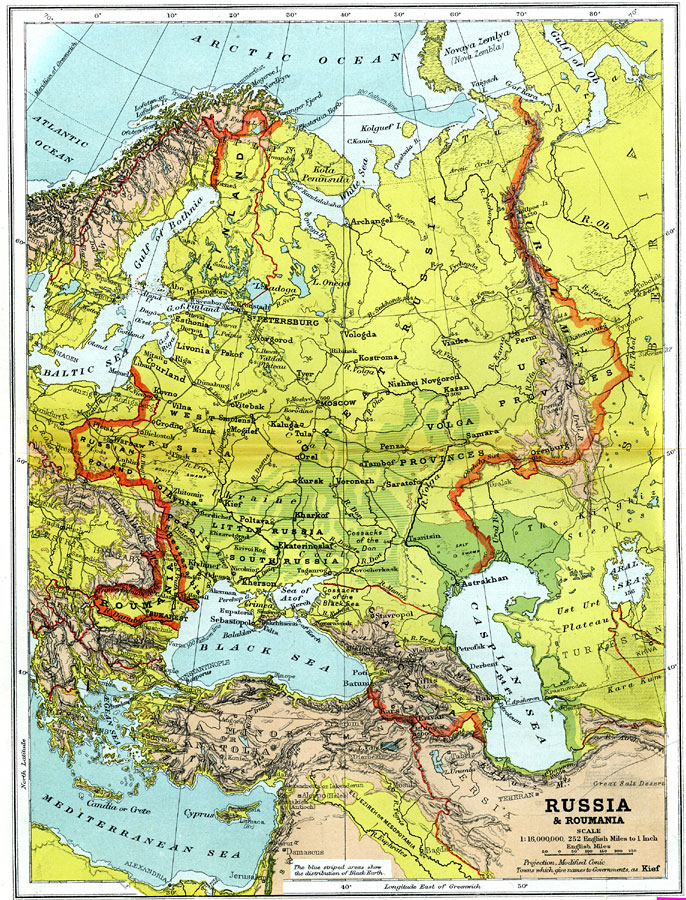
Description: A geo–political map from 1904 of Russia and Roumania (Romania) showing country borders, capitals and major cities, railroad lines, canals and navigable rivers. Physical features include mountain ranges with elevation measured in feet, major rivers and watersheds, lowlands, water depths in feet for large lakes and the 100–fathom line in the offshore waters. Generalized elevations shown as land below sea level colored dark green (Caspian Sea region) land below 1,000 feet colored light green, and land above 1,000 feet in elevation colored brown. Blue striped areas of the map indicate the distribution of Black Earth (rich Chernozemic soils of the Ukraine and southern Volga provinces). The Russian boundaries on this map extend from Warsaw in the west to the Ural Mountains in the East.
Place Names: Eastern Europe, Roumania, �Great Russia, �Little Russia, �Russian Poland, �Siberia, �Finland, �Black Sea, �Caspian Sea, �Aral Sea, �Ural Mountains, �River Volga, �Moscow, �Kief, �St. Petersburg, �Leningrad, �Crimea, �Archangel, �Gulf of Bothnia, �Bukares
ISO Topic Categories: boundaries,
elevation,
inlandWaters,
oceans,
transportation
Keywords: Russia and Roumania, physical, �political, �transportation, �Modified Conic Projection, physical features,
topographical, country borders,
major political subdivisions, railroads,
water routes, boundaries,
elevation,
inlandWaters,
oceans,
transportation, Other, 1904
Source: Geo. G. Chisholm and C.H. Leete, eds., Longmans' New School Atlas (New York, NY: Longmans, Green, and Co., 1904) 31
Map Credit: Courtesy the private collection of Roy Winkelman |
|