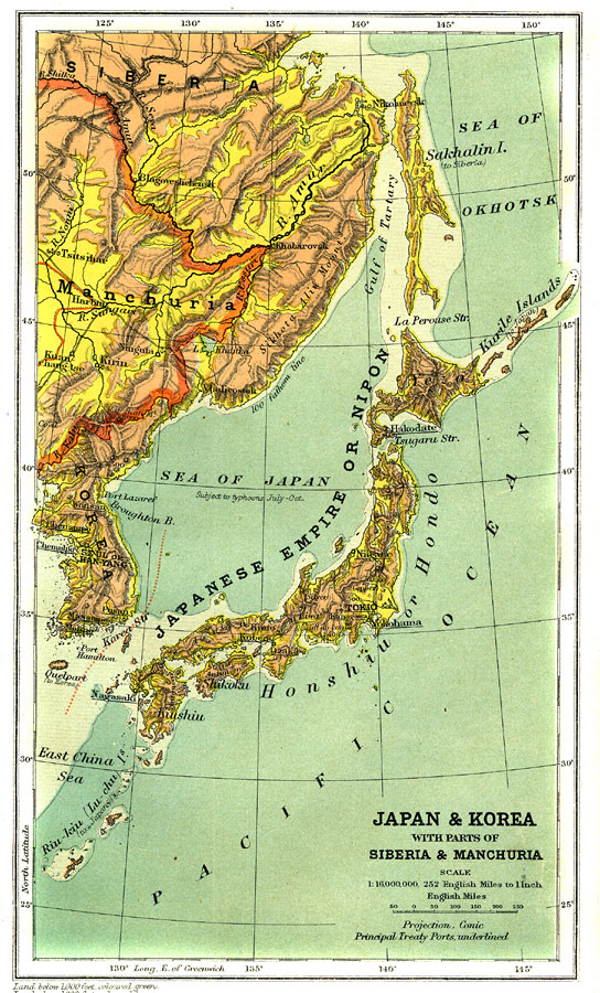
Description: The Japanese Empire or Nipon (Japan) and Korea showing country borders current to 1904, major cities, railroad lines, and navigable rivers. Physical features include mountain ranges with elevation measured in feet, major rivers and watersheds, and the 100-fathom line in the offshore waters. Generalized elevations shown as land below 1,000 feet colored light green, and land above 1,000 feet in elevation colored brown. An inset map of England is included for showing comparative scaled area.
Place Names: Eastern Asia, Japan, �Korea, �Han Yang, �Seoul, �Tokio, �Tokyo, �Sea of Japan,
ISO Topic Categories: boundaries,
elevation,
inlandWaters,
oceans,
transportation
Keywords: Japan and Korea with Parts of Siberia and Manchuria, physical, �political, �transportation, �Conic Projection, physical features,
topographical, country borders, railroads,
water routes, boundaries,
elevation,
inlandWaters,
oceans,
transportation, Other, 1904
Source: Geo. G. Chisholm and C.H. Leete, eds., Longmans' New School Atlas (New York, NY: Longmans, Green, and Co., 1904) 37
Map Credit: Courtesy the private collection of Roy Winkelman |
|