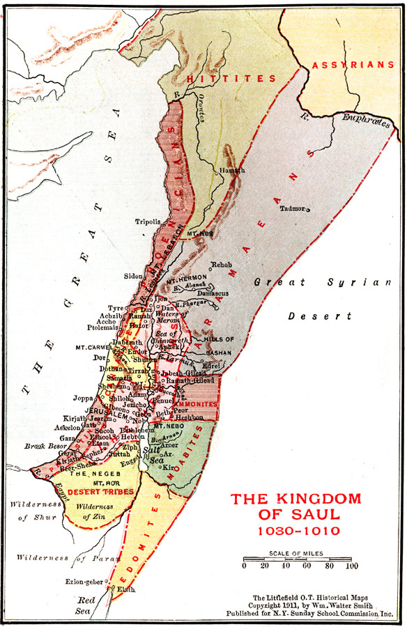
Description: A map of the regions of Palestine during the Biblical era of the Kingdom of Saul (1030–1010 BC) showing principal cities, mountains, rivers, and the territories of the Hittites, Assyrians, Phoenicians, Aramaeans, Canaanites, Hebrews, Ammonites, Philistines, Moabites, Desert tribes, and Edomites.
Place Names: A Regional Map of Asia, Great Sea, �Mediterranean Sea, �Salt Sea, �Dead Sea, �Mt. Carmel, �Mt Lebanon, �Mt. Hermon, �Jerusalem, �Joppa, �Gaza,
ISO Topic Categories: location,
inlandWaters,
boundaries
Keywords: Palestine during the Kingdom of Saul, physical, �political, physical features, major political subdivisions, location,
inlandWaters,
boundaries, Unknown, 1030–1010 BC
Source: William Walter Smith, The Students' Illustrated Historical Geography of the Holy Land (Philadelphia, PA: The Sunday School Times Company, 1911) 65
Map Credit: Courtesy the private collection of Roy Winkelman |
|