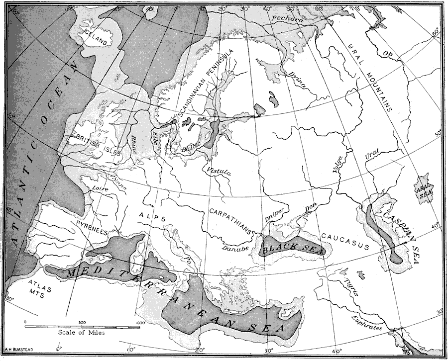
Description: An outline map of Europe at a time when sea levels were lower than present, with Iceland, the British Isles and Scandinavian Peninsula a part of the mainland, and the Mediterranean, not connected to the Atlantic Ocean, split into two bodies of water by an Italian–African land bridge. This map also shows extensions of major river routes as they would have appeared at the time.
Place Names: A Complete Map of Europe, Alps, �Black Sea, �Caspian Sea, �Euphrates River, �Iceland, �Mediterranean Sea, �Pyrenees, �Scandinavian peninsula, �Tigris River,
ISO Topic Categories: oceans,
location,
inlandWaters
Keywords: Outline Map of Europe, Age of Man, �historical, �Old Stone Age, �physical, �prehistoric, kGlacial, kHydrologic, physical features, oceans,
location,
inlandWaters, Unknown, 5,000 BCE
Source: Gilbert H. Grosvenor, ed., The National Geographic Magazine An Illustrated Monthly (Washington, DC: Judd & Detweiler Inc. , 1916) 113
Map Credit: Courtesy the private collection of Roy Winkelman |
|