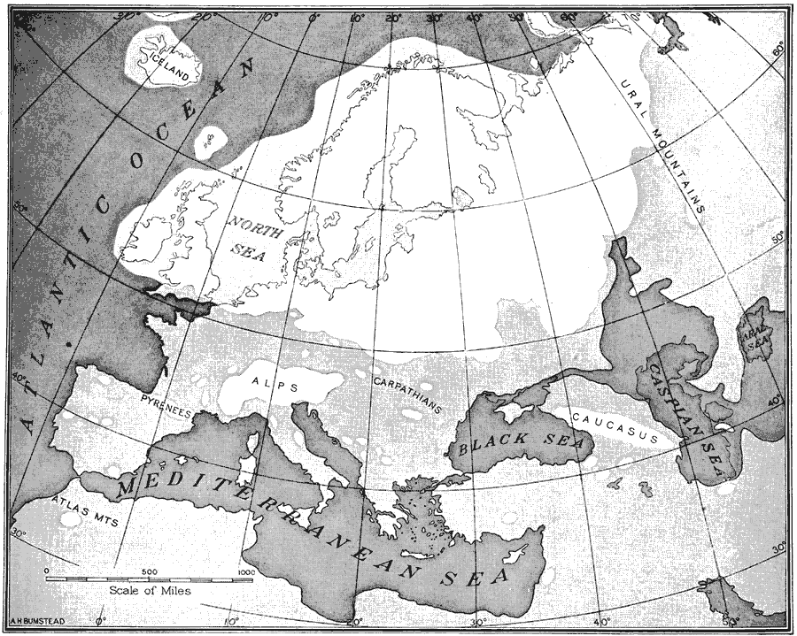
Description: Map of Europe, showing the great sheet of ice that covered the British Isles, Scandinavia, Germany, and half of Russia during the second Glacial Age.
Place Names: A Complete Map of Europe, Alps, �Aral Sea, �Atlantic Ocean, �Black Sea, �British Isles, �Caspian Sea, �Germany, �Iceland, �Mediterranean Sea, �North Sea, �Pyrenees, �Scandinavia, �Ural Mountain
ISO Topic Categories: oceans,
location,
inlandWaters
Keywords: Map of Europe, Glacial Age, �historical, �physical, �prehistoric, kGlacial, physical features, oceans,
location,
inlandWaters, Unknown, 25,000 YBP
Source: Gilbert H. Grosvenor, ed., The National Geographic Magazine An Illustrated Monthly (Washington, DC: Judd & Detweiler Inc. , 1916) 115
Map Credit: Courtesy the private collection of Roy Winkelman |
|