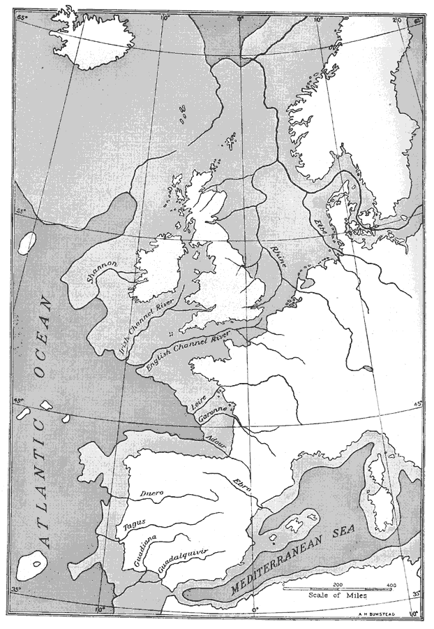
Description: Map of Western Europe, at a time when sea levels were much lower and the British Isles were connected with the mainland. Major river routes are shown extending to the theoretical coastline of the period. According to the authors in 1916, during this period the Piltdown man was living in England and France. The Piltdown man was revealed as a hoax in 1953.
Place Names: A Complete Map of Europe, Atlantic Ocean, �Black Sea, �British Isles, �England, �France, �Mediterranean Se
ISO Topic Categories: oceans,
location,
inlandWaters
Keywords: Western Europe during the Third Inter-Glacial Stage, Glacial Age, �historical, �physical, �prehistoric, kGlacial, physical features, oceans,
location,
inlandWaters, Unknown, 25,000 BCE
Source: Gilbert H. Grosvenor, ed., The National Geographic Magazine An Illustrated Monthly (Washington, DC: Judd & Detweiler Inc. , 1916) 118
Map Credit: Courtesy the private collection of Roy Winkelman |
|