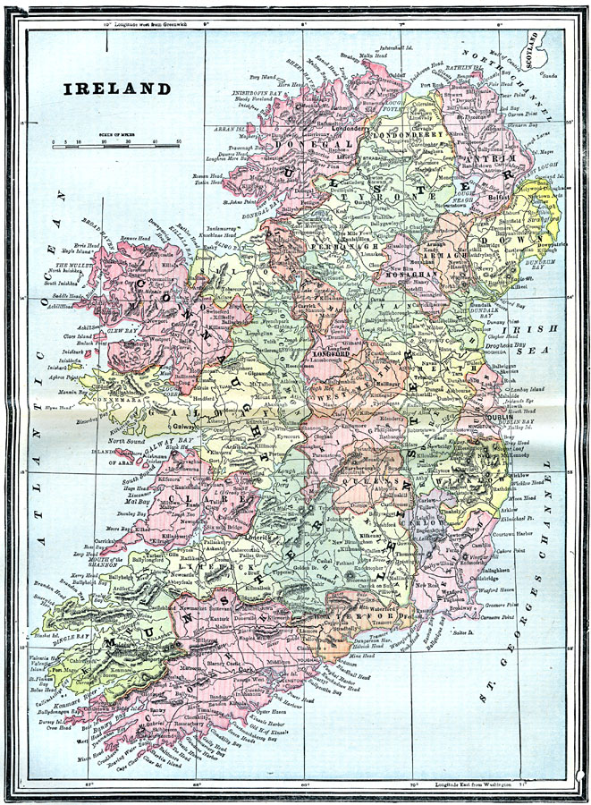
Description: Map of Ireland in 1903, showing major cities, towns, and ports, railways, rivers, and coastal features. This map shows the provinces of Ulster, Connaught, Leinster, and Munster, and is color–coded to show the counties of each province.
Place Names: Ireland, Antrim, �Clare, �Connaught, �Cork, �Donegal, �Dublin, �Galway, �Killarney, �Leinster, �Limerick, �Londonderry, �Monaghan, �Munster, �UIster, �Waterford, �Wexford, �Slig
ISO Topic Categories: oceans,
location,
inlandWaters
Keywords: Ireland, physical, �political, county borders, oceans,
location,
inlandWaters, Unknown, 1903
Source: Spencer Baynes, LL.D., and W. Robertson Smith, LL.D., eds., The Encyclopedia Britannica vol. 13 (New York, NY: The Werner Company, 1903)
Map Credit: Courtesy the private collection of Roy Winkelman |
|