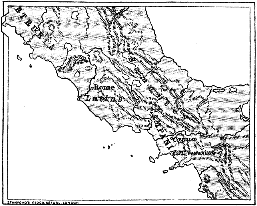
Description: Map of the vicinity of Rome showing the area claimed by the Samnites and the Greek city south of Rome: Capua. "The Samnites so distressed one of these cities, Capua, that she called on the Romans to help her, in the year 343. This was the beginning of the Samnite wars, which lasted more than 50 years, that is, to the year 290." — Creighton, 1890
Place Names: Italy, Rome, �Etruria, �Campania, �Capua, �Mt. Vesuviu
ISO Topic Categories: society
Keywords: Rome and the Samnites, physical, �historical, kRomanEmpire, physical features,
topographical, society, Unknown, 343–290 BC
Source: M. Creighton, History of Rome (New York, NY: D. Appleton and Company, 1890) 27
Map Credit: Courtesy the private collection of Roy Winkelman |
|