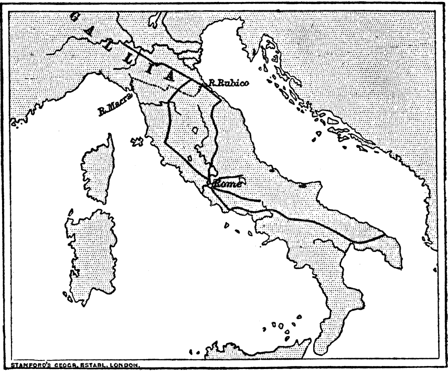
Description: Map showing the road system across the Apennine Peninsula developed by the Romans during the early stages of their empire. "The Romans were great makers of roads. They made them so well and so strong that many Roman roads still remain in use at the present day. These roads went from Rome to different parts of Italy, and so Rome could send soldiers where they were wanted, and could get news quickly. This was very useful as a way of keeping order. You will see from the map how they were spread over Italy, and served as so many chains by which Rome fastened other cities to herself." — Creighton, 1890
Place Names: Italy, Gallia, �River Rubicon, �River Macra,
ISO Topic Categories: boundaries,
society,
transportation
Keywords: The Roman Roads in Italy, physical, �transportation, �historical, kRomanEmpire, physical features, roads, boundaries,
society,
transportation, Unknown, 753–275 BC
Source: M. Creighton, History of Rome (New York, NY: D. Appleton and Company, 1890) 34
Map Credit: Courtesy the private collection of Roy Winkelman |
|