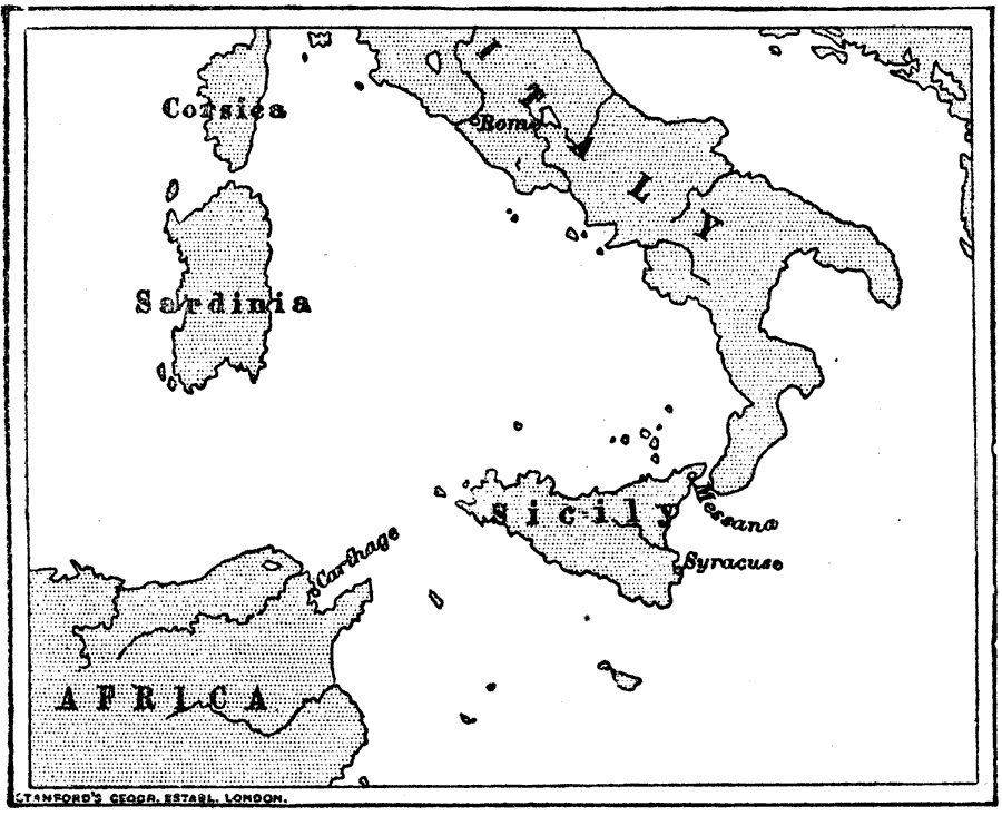
Description: "Carthage, as you will see on the map, was a town on the north coast of Africa, at the point where the African coast is nearest to Sicily...The Sicels, who gave their name to Sicily, were an Italian people, very like the Latins at first. But the Greeks planted colonies in Sicily as early as 735 [BC], and Sicles learned to be like the Greeks. These Greeks were traders as well as the Carthaginians, so the two were always fighting, especially as the Carthaginians settled on the west coast of Sicily and tried to drive out the Greeks...3. First Punic War. — The cause of these Phœnician, or Punic wars, as the wars with Carthage are called, was this. Some Italian pirates had settled in Messana, the nearest city in Sicily to Italy. Both the Greeks and Carthaginians wished to drive them out, so the pirates called to Rome for help, and Rome, not wishing the Carthaginians to take Messana, sent help; so a war began which was to last twenty-two years (264-241)." — Creighton, 1890
Place Names: Italy, Rome, �Messina, �Messana, �Syracuse, �Carthag
ISO Topic Categories: society
Keywords: Rome and Carthage, physical, �historical, physical features, society, Unknown, 264–241 B.C.
Source: M. Creighton, History of Rome (New York, NY: D. Appleton and Company, 1890) 36
Map Credit: Courtesy the private collection of Roy Winkelman |
|