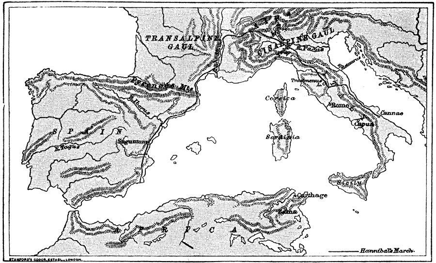
Description: A map of Hannibal's route from Cartagena, Spain, to Cannæ, Italy, during the Second Punic War against the Romans. This map of the Mediterranean region, including Carthage in North Africa, Spain, southern France, and Italy shows Hannibal's route from southern Spain, through the Pyrenees Mountains, across the Rhodanus (Rhone) River, over the Alps to Cisalpine Gaul (Lombardy), an on to Cannæ.
Place Names: Western and Central Europe, France, �Italy, �Spain, �Carthage, �Saguntum, �Pyrenees Mountains, �Transalpine Gaul, �River Rhodanus, �River Rhone, �Cisalpine Gaul, �Lombardy, �River Padus, �River Po, �River Ticinus, �River Trebbia, �Lake Trasimenus, �Cannae, �Capu
ISO Topic Categories: inlandWaters,
society
Keywords: Hannibal's March to Italy, physical, �historical, kHannibal, physical features,
topographical, inlandWaters,
society, Unknown, 219–216 BC
Source: M. Creighton, History of Rome (New York, NY: D. Appleton and Company, 1890) 42
Map Credit: Courtesy the private collection of Roy Winkelman |
|
