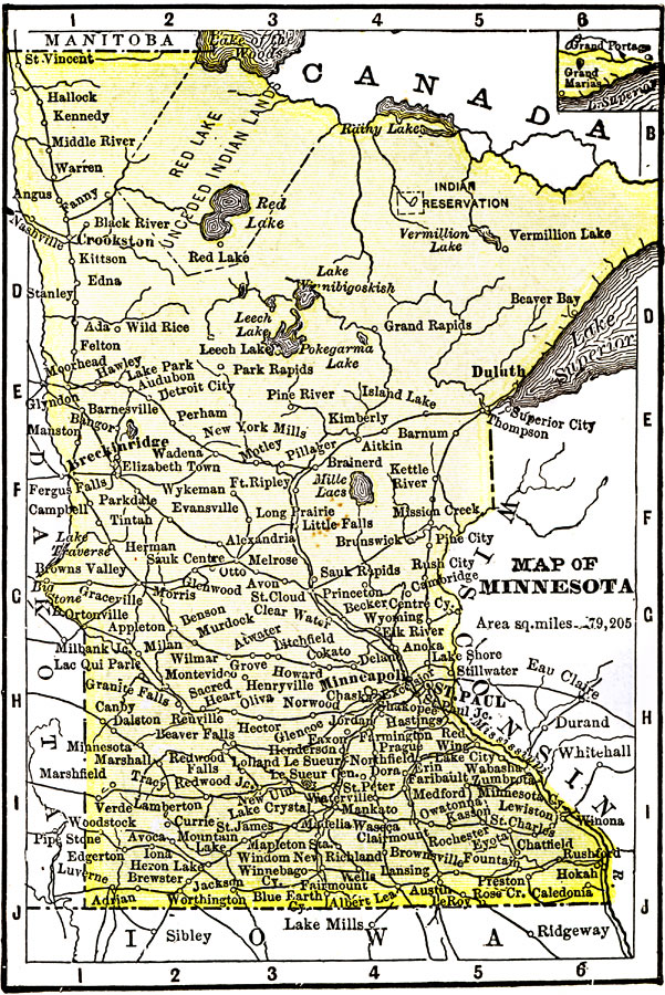
Description: A map from 1904 of Minnesota showing the capital of Minneapolis (St. Paul since 1849), major cities and towns, Indian reservations, railroads, lakes, and rivers. "Minnesota (Gopher State) — Was first settled in 1812. Admitted to the Union in 1858. Has an area of 83,365 square miles and a population of 1,799,000. There are immense tracts of white and Norway pine and extensive fields in the State. It leads all others in the value of its flour and grist mill products. Minneapolis is the center of flour mill industry. The second industry of importance is lumbering. The manufacture of malt liquors is of great importance. Ranks sixteenth in wealth, nineteenth in population, ninth in railways, and thirteenth in square miles. The Governor receives a salary of $5,000. Capital is Minneapolis." &mdash Wark 1904.
Place Names: Minnesota, Minneapolis, �St. Paul, �Winona, �Mankato, �Lake Superior, �Red Lake, �Vermillion Lake, �Leech Lak
ISO Topic Categories: inlandWaters,
planningCadastre,
transportation
Keywords: Minnesota, physical, �political, �transportation, kNativeAmerican, physical features, major political subdivisions, railroads, inlandWaters,
planningCadastre,
transportation, Unknown, 1904
Source: Henry Wark, ed., Wark's Modern Educator (New York, NY: Henry Wark, 1904) 875
Map Credit: Courtesy the private collection of Roy Winkelman |
|