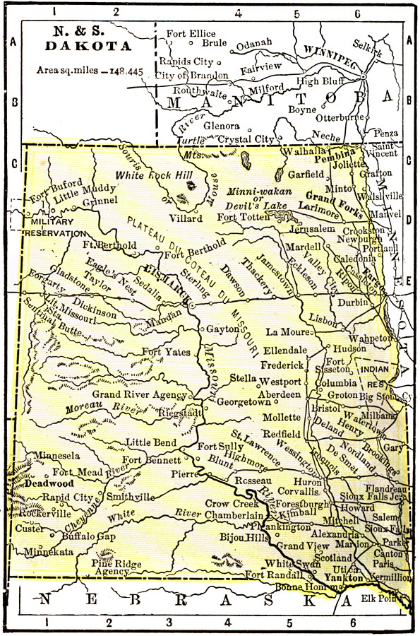
Description: "North and South Dakota – The territory of Dakota was organized in 1861. In 1899 it was divided into North and South Dakota, which were admitted as States at the same time. North Dakota has an area of 70,795 square miles; South Dakota has 77,650 square miles. The populations are respectively 330,000 and 401,570. The principal industries of the two states are agriculture, stock-raising, and mining. The most important industry of the two States is the manufacture of flour and grist mill products. The Governor of North Dakota receives a salary of $3,000; that of South Dakota, $2,500." &mdash Wark 1904
Place Names: Midwest States, North Dakota, �South Dakota, �Grand Forks, �Deadwood, �Cheyenne River, �Missouri River, �Bismarck, �Sioux Falls, �Yankto
ISO Topic Categories: society,
transportation
Keywords: The Dakotas, transportation, �political, �physical, physical features,
topographical, country borders, railroads, society,
transportation, Unknown, 1904
Source: Henry Wark, ed. , Wark's Modern Educator (New York, NY: Henry Wark, 1904) 876
Map Credit: Courtesy the private collection of Roy Winkelman |
|