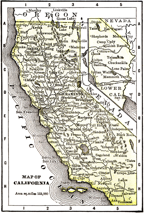
Description: A map of California from 1904 showing the State capital of Sacramento, major cities and towns, railroads, mountain systems, lakes, rivers, and coastal features. "California, first settlement made in 1769 by the Spaniards. Gold was discovered in 1848. California was admitted to statehood in 1850 without passing through the intermediate stage of a Territory. Area, 115,980 square miles, and population, 1,485,053. As the gold mines declined the soil became the chief source of the productiveness for the State. Grain and fruit are the chief products. Ranks second in gold, third in copper, third in square miles, and twenty-first in population. The capital is Sacramento, and the Governor receives a salary of $6,000." &mdash Wark 1904.
Place Names: California, San Diego, �San Francisco, �Santa Barbara, �Oakland, �Los Angeles, �Humboldt, �Sacrament
ISO Topic Categories: society,
transportation
Keywords: California, transportation, �political, �physical, physical features,
topographical, major political subdivisions, railroads, society,
transportation, Unknown, 1904
Source: Henry Wark, ed. , Wark's Modern Educator (New York, NY: Henry Wark, 1904) 878
Map Credit: Courtesy the private collection of Roy Winkelman |
|