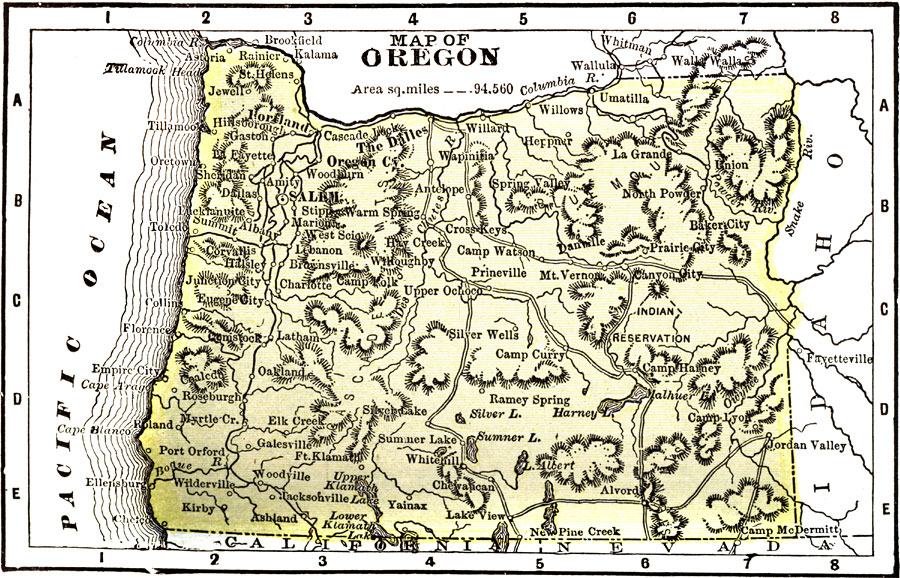
Description: A map from 1904 of Oregon showing the capital of Salem, principal cities and towns, railroads, stage lines, mountains, rivers, and coastal features. "Oregon — Organized as a Territory in 1848; became a state in 1859. Area, 96,030 square miles; population, 424,000. Oregon stands thirty–eighth in population, and thirtieth in manufacturing. The manufacture of lumber and timer is the leading industry, while the Columbia River furnishes nearly all the canned salmon used in the United States. The industry of fish canning is carried on almost entirely by the Chinese. The Governor receives a salary of $1,500." — Wark 1904.
Place Names: Oregon, Salem, �Oregon City, �Eugene City, �Astori
ISO Topic Categories: society,
transportation
Keywords: Oregon, physical, �political, �transportation, physical features,
topographical, major political subdivisions, railroads, society,
transportation, Unknown, 1904
Source: Henry Wark, ed. , Wark's Modern Educator (New York, NY: Henry Wark, 1904) 878
Map Credit: Courtesy the private collection of Roy Winkelman |
|