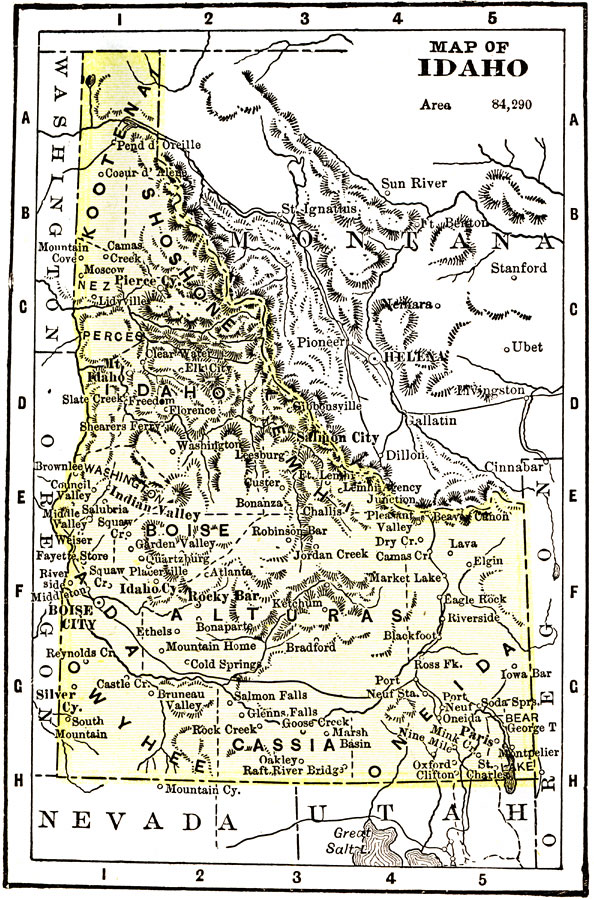
Description: A map from 1904 of Idaho showing the capital of Boise City, counties, towns, railroads, mountain systems, lakes, and rivers. "Idaho was created as a Territory in 1863. Admitted to statehood in 1890. Gold discovered in 1860. Area, 84,290 square miles; population, 169,000. Mining and agriculture are the principal industries. The manufacture of lumber and timber products comes next. The mountains are well supplied with gold, silver, lead, and copper. Idaho ranks third in silver, ninth in gold, forty–fifth in wealth, and forty–seventh in population. The Governor receives a salary of $3,000." &mdash Wark 1904.
Place Names: Idaho, Boise City, �Cassia, �Oneida, �Alturas, �Salmon City, �Kootenai, �Mt. Idaho, �Shoshon
ISO Topic Categories: transportation,
society
Keywords: Idaho, physical, �political, �transportation, physical features,
topographical, major political subdivisions,
county borders, railroads, transportation,
society, Unknown, 1904
Source: Henry Wark, ed. , Wark's Modern Educator (New York, NY: Henry Wark, 1904) 879
Map Credit: Courtesy the private collection of Roy Winkelman |
|