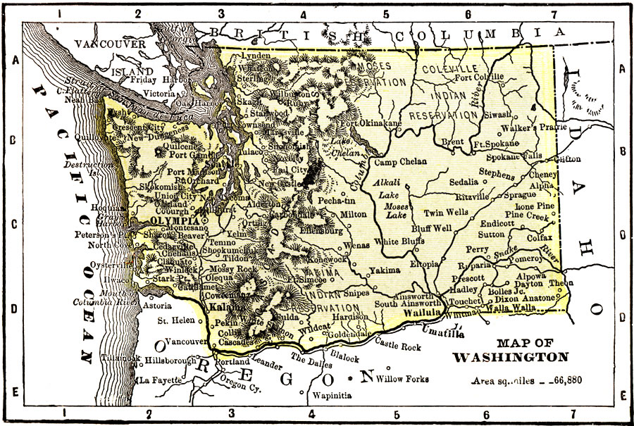
Description: A map from 1904 of Washington showing the capital, Olympia, principal cities and towns, Indian reservations, railroads, mountains, rivers, and coastal features. "Washington — Organized as a Territory in 1853. Admitted to statehood in 1899. Area, 69,180 square miles; population, 535,000. The manufacture of timber and lumber products ranks as the most important industry, the characteristic product being red–fir lumber and cedar shingles. The manufacture of flour and grist mill products ranks second; fish canning and preserving ranks third. Salmon and oysters are shipped extensively. Copper smelting and refining, the manufacture of iron and steel products, and he manufacture of paper and wood pulp are important industries. Ranks twenty–ninth in wealth, and thirty–third in population. Seattle is the leading port in the northwest." — Wark, 1904.
Place Names: Washington, Olympia, �Tacoma, �Seattle, �Kalama, �Spokan
ISO Topic Categories: society,
transportation
Keywords: Washington, physical, �political, �transportation, kNativeAmerican, physical features, major political subdivisions,
country borders, railroads, society,
transportation, 1904
Source: Henry Wark, ed. , Wark's Modern Educator (New York, NY: Henry Wark, 1904) 879
Map Credit: Courtesy the private collection of Roy Winkelman |
|