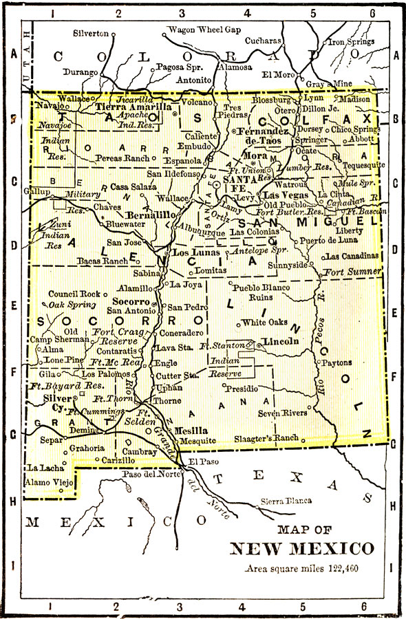
Description: "New Mexico was ceded to the United States in 1848. Since 1875 the question of the admission o New Mexico as a State had been before Congress. Has an area of 122,460 square miles, and a population of 199,000. Ranks eighth in silver, eleventh in gold, sixth in copper, forty-seventh in wealth. Mining and stock raising are the most important industries, agriculture ranking next. Irrigation has made considerable progress. The Governor receives a salary of $2,600." &mdash Wark 1904
Place Names: New Mexico, Silver City, �Sante Fe, �Tierra Amarilla, �Colfax, �Socorro, �Lincoln, �San Migue
ISO Topic Categories: transportation,
society
Keywords: New Mexico, physical, �political, �transportation, kNativeAmerican, physical features, country borders,
major political subdivisions,
county borders, railroads, transportation,
society, Unknown, 1904
Source: Henry Wark, ed. , Wark's Modern Educator (New York, NY: Henry Wark, 1904) 880
Map Credit: Courtesy the private collection of Roy Winkelman |
|