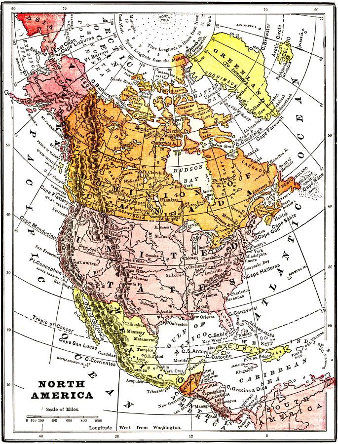
Description: A map from 1904 of North America, Central America, Greenland, and the Caribbean showing political boundaries at the time, capitals and major cities, mountain systems, lakes, rivers, and coastal features of the region.
Place Names: A Complete Map of North America, Bahamas, �Canada, �Cuba, �United States, �Mexico, �Greelan
ISO Topic Categories: society,
oceans
Keywords: North America, physical, �political, physical features,
topographical, country borders, society,
oceans, Unknown, 1904
Source: Henry Wark, ed. , Wark's Modern Educator (New York, NY: Henry Wark, 1904) 894
Map Credit: Courtesy the private collection of Roy Winkelman |
|