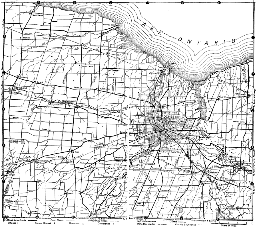
Description: A road map of New York in the vicinity of Rochester from the 1920 Automobile Club of Rochester, showing county lines, principal cities and towns, rivers, and is keyed to show the best auto routes, other auto routes, unreported roads, railroads, and canals.
Place Names: New York, Rochester, �Hamlin, �Clarkson, �Churchville, �Manitou Beach, �Fairport, �Webster, �Lake Ontario, �Charlotte, �Pittsford,
ISO Topic Categories: location,
inlandWaters,
transportation
Keywords: Rochester and Vicinity, physical, �transportation, �political, kAutomobile, physical features, county borders, roads,
railroads,
water routes, location,
inlandWaters,
transportation, Unknown,1920
Source: , Automobile Club of Rochester (New York, NY: The Automobile Club of Rochester, 1920) 8-9
Map Credit: Courtesy the private collection of Roy Winkelman |
|