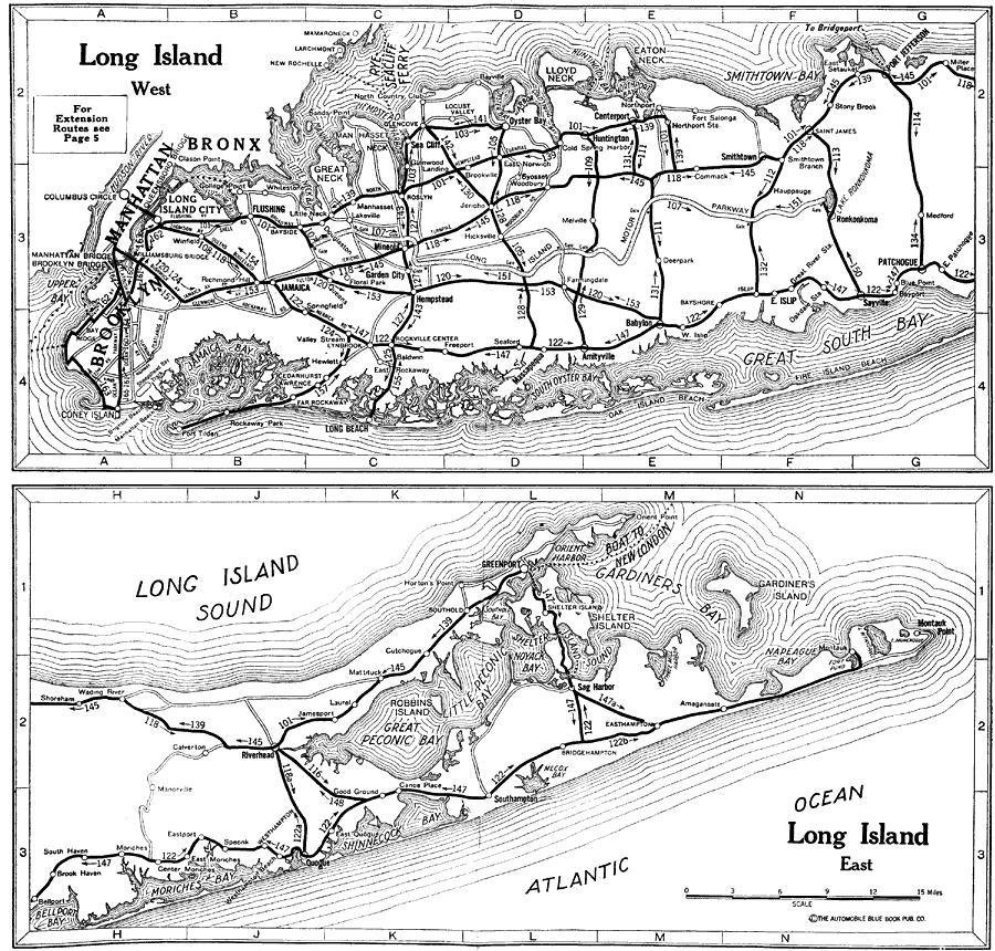
Description: A road map of Long Island from the Official Automobile Blue Book (1919), showing principal cities and towns, ferry routes, and is keyed to show the best auto routes, and other auto routes.
Place Names: New York, Brooklyn, �Manhattan, �Bronx, �Port Jefferson, �Flushing, �Jamaica, �Coney Island, �Riverhead, �Robbins Island, �Gardiner's Island, �Greenport, �Montauk Point,
ISO Topic Categories: location,
inlandWaters,
transportation
Keywords: Long Island , physical, �transportation, kAutomobile, physical features, roads, location,
inlandWaters,
transportation, Unknown,1920
Source: , Automobile Club of Rochester (New York, NY: The Automobile Club of Rochester, 1920) 6
Map Credit: Courtesy the private collection of Roy Winkelman |
|