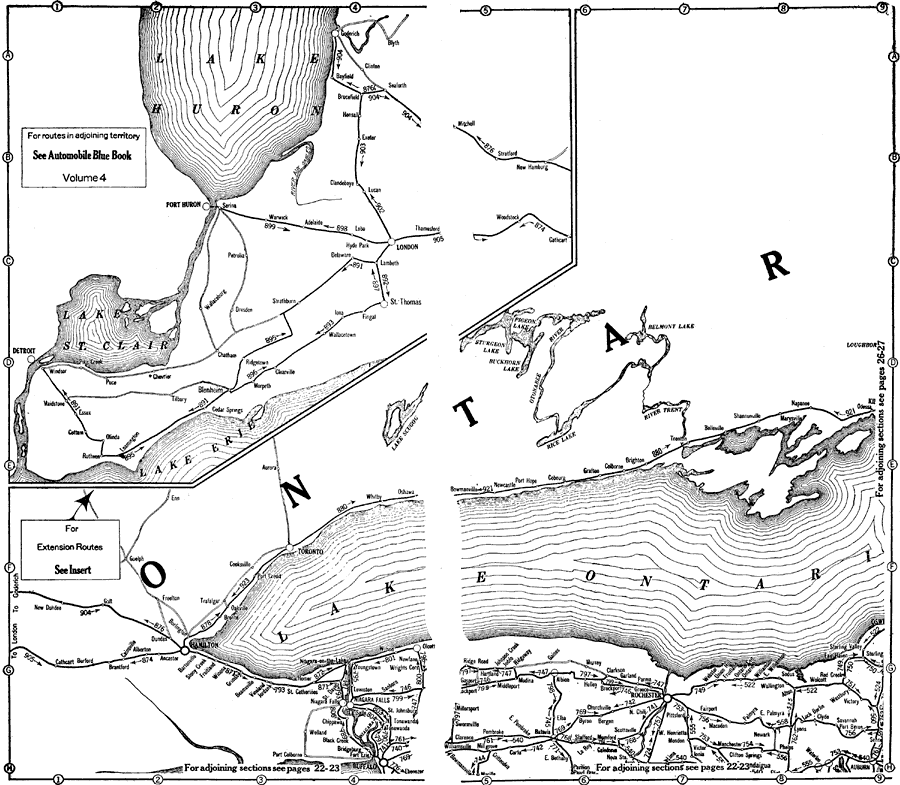
Description: A map from the 1920 Automobile Club of Rochester showing automobile routes in the Great Lakes Region, around western Lake Ontario, and the Canadian portion of Lake St. Clair and southern Lake Huron. The map shows route numbers, mileages and terminals only.
Place Names: A Regional Map of North America, Canada, �United States, �Lake Huron, �Lake St. Clair, �Lake Erie, �Lake Ontario, �Port Huron, �London, �Hamilton, �Niagara Falls, �Rochester, �New York, �Toronto,
ISO Topic Categories: boundaries,
inlandWaters,
location,
transportation
Keywords: Automobile Routes of the Great Lake Vicinity, physical, �political, �transportation, kAutomobile, physical features, country borders, roads, boundaries,
inlandWaters,
location,
transportation, Unknown,1920
Source: , Automobile Club of Rochester (New York, NY: The Automobile Club of Rochester, 1920) 24-25
Map Credit: Courtesy the private collection of Roy Winkelman |
|