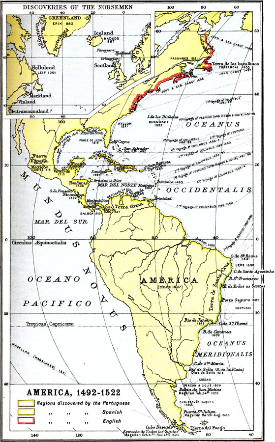
Description: A map of the Americas showing the routes taken by early European explorers from the four voyages of Columbus (1492–1502) to the voyage of Juan Bermudez (1522). The map is color–coded to show the regions explored by the Portuguese, Spanish, and English. An inset map shows the regions explored by the Norsemen, including Iceland (reached in AD 867), Greenland (AD 982), and Helluland in North America (1001).
Place Names: Regional Americas, North America, �South America, �Mundus Novus, �Mar Del Sur, �Mar Del Norte, �Los Cayos, �Terra Firma, �Americ
ISO Topic Categories: physical, �historical, �transportation, kWorldAmericas
Keywords: European Exploration of the Americas, physical, �historical, �transportation, physical features, water routes, physical, �historical, �transportation, kWorldAmericas, Unknown, 1492–1522
Source: Ernest Rhys, Ed., A Literary and Historical Atlas of North & South America (New York, NY: E.P. Dutton & CO., 1911) 3
Map Credit: Courtesy the private collection of Roy Winkelman |
|