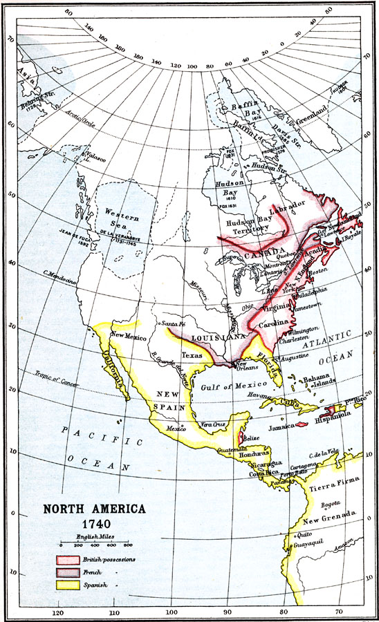
Description: A map of North America, Central America, and the Greater Antilles showing the territorial possessions of Britain, Spain, and France in 1740 at the beginning of the King George's War (1740–1748). This map shows the unexplored territories to the west and north of the claimed lands with dashed lines, and includes the Pacific exploration of Juan de Fuca, English areas of exploration for the Northwest Passage from the Atlantic to Pacific, and the fabled ‘West Sea’ sought by the French (Pierre Gaultier de la Vérendrye).
Place Names: A Regional Map of North America, Louisiana, �Canada, �Virginia, �Carolina, �Texas, �New Spain, �New Mexico, �Florida, �United State
ISO Topic Categories: society,
boundaries
Keywords: North America, political, �physical, physical features, society,
boundaries, Unknown, 1740
Source: Ernest Rhys, Ed., A Literary and Historical Atlas of North & South America (New York, NY: E.P. Dutton & CO., 1911) 7
Map Credit: Courtesy the private collection of Roy Winkelman |
|