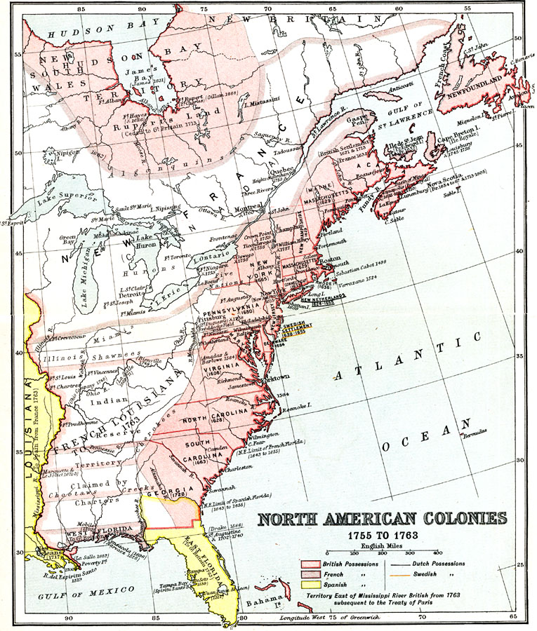
Description: A map of eastern North America showing the colonial possessions at the time of the French and Indian War (1755–1763). The map is color–coded to show the possessions of the Britain, France, and Spain during the period. The Dutch and Swedish possessions and settlements are underlined. The map shows dates of early exploration, settlement, establishment of forts, and significant battles. The map notes the territory east of the Mississippi River (French Florida and New France) as British subsequent to the Treaty of Paris in 1763. The map also shows the Native tribal areas, and the lands reserved for them by the British between the Mississippi River and the watershed divide of the Appalachian Mountains.
Place Names: A Regional Map of North America, Canada, �United States, �New France, �French Louisiana, �East Florida, �West Florida, �New York, �Pennsylvania, �Louisian
ISO Topic Categories: society,
boundaries
Keywords: North American Colonies, political, �physical, �historical, kNativeAmerican, physical features, society,
boundaries, Unknown, 1755–1763
Source: Ernest Rhys, Ed., A Literary and Historical Atlas of North & South America (New York, NY: E.P. Dutton & CO., 1911) 8
Map Credit: Courtesy the private collection of Roy Winkelman |
|