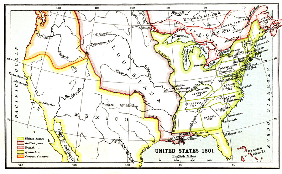
Description: A map of the United States in 1801. The map is color–coded to show the States and territory of the United States west to the Mississippi River, the British territories of Upper and Lower Canada, Rupert's Land, and the Bahamas, the French possession of Louisiana, the Spanish territories of Mexico and Florida, and the Oregon Country.
Place Names: Growth of Nation, Mexico, �Louisiana, �Tennessee, �Georgia, �Kentucky, �Canada, �New York, �Carolin
ISO Topic Categories: society,
boundaries
Keywords: United States, political, �physical, �historical, physical features, society,
boundaries, Unknown, 1801
Source: Ernest Rhys, Ed., A Literary and Historical Atlas of North & South America (New York, NY: E.P. Dutton & CO., 1911) 14
Map Credit: Courtesy the private collection of Roy Winkelman |
|