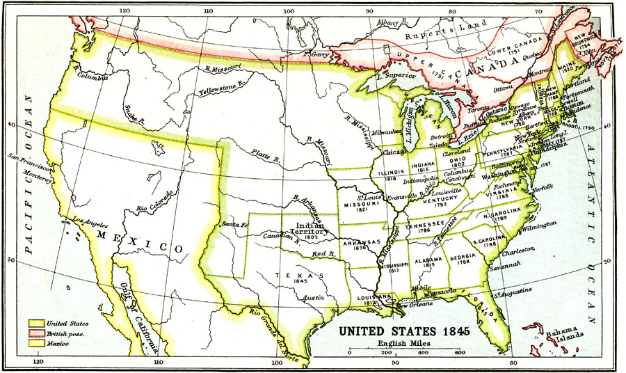
Description: A map of the United States in 1845 after the Louisiana Purchase, the Lewis and Clark Expedition, and the annexation of Texas. The map is color–coded to show the States and territory of the United States west to the Pacific with the dates of statehood given, the British territories of Upper and Lower Canada, Rupert's Land, New Brunswick, Nova Scotia, and the Bahamas, and the territory of Mexico.
Place Names: Growth of Nation, Los Angeles, �New Orleans, �New York, �Mexico, �Louisiana, �Canada, �Tennessee, �Carolina, �New York, �Virginia, �Texas, �Illinois, �Missouri, �Arkansas, �Indian Terriory, �Kentuck
ISO Topic Categories: society,
boundaries
Keywords: United States, physical, �political, �historical, physical features, society,
boundaries, Unknown, 1845
Source: Ernest Rhys, Ed., A Literary and Historical Atlas of North & South America (New York, NY: E.P. Dutton & CO., 1911) 15
Map Credit: Courtesy the private collection of Roy Winkelman |
|