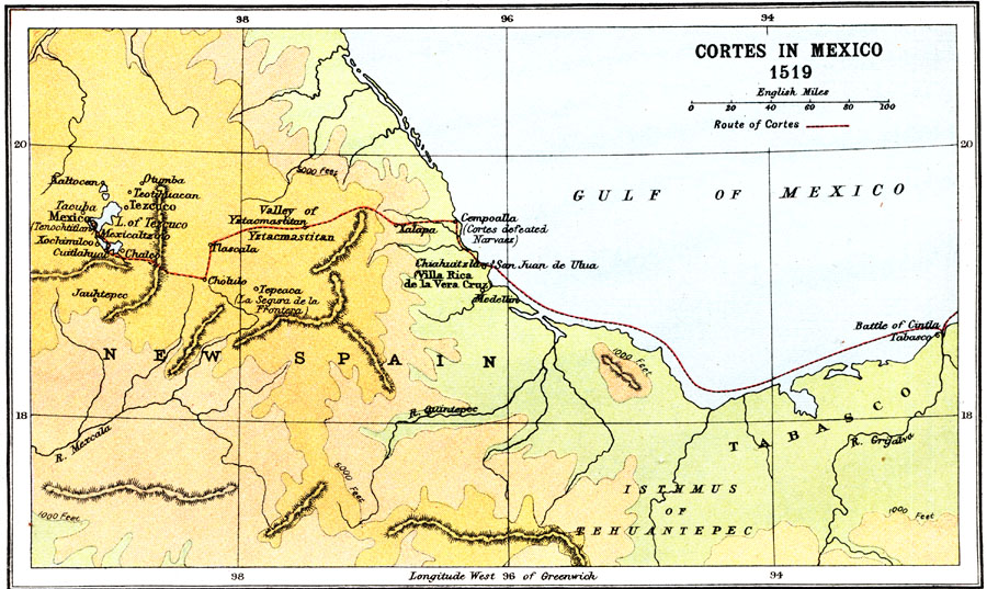
Description: A map showing the expedition of Hernán Cortes in 1519. This expedition was the third to the mainland and took him all the way into Mexico. This map shows the route from the Battle of Cintla (Tabasco) to Veracruz (Villa Rica de la Vera Cruz) where Cortez dismissed the authority of the governor of Cuba (Velázquez), then turned inland to the Aztec capital of Tenochtitlan (Mexico City). The map also shows the site where Cortez, after conquering Tenochtitlan, returned to the coast (Cempoalla) to confront and defeat the Spaniard Pánfilo de Narváez, sent by Velázquez to oppose Cortez (1520).
Place Names: Mexico, Mexico City, �Tabasco, �Yzacmastitan, �Cholulo, �Cempoalla, �New Spain, �Tezuco, �Xalapa, �San Juan de Ulua, �Tehuantepec,
ISO Topic Categories: transportation,
society
Keywords: Cortes in Mexico, physical, �transportation, �historical, physical features, historical event, transportation,
society, Unknown, 1519
Source: Ernest Rhys, Ed., A Literary and Historical Atlas of North & South America (New York, NY: E.P. Dutton & CO., 1911) 18
Map Credit: Courtesy the private collection of Roy Winkelman |
|