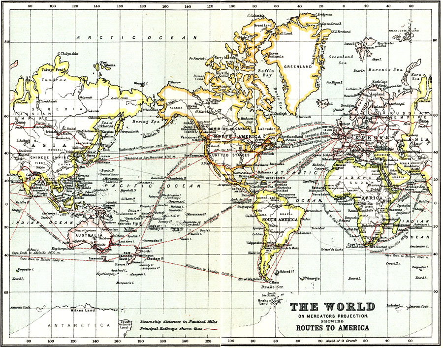
Description: A world map from 1911 on a Mercator's Projection, showing commercial routes to North and South America. The map shows principal railways and steamship routes with distances between ports given in nautical miles.
Place Names: A Complete Map of Globes and Multi-continent, Africa, �Antarctica, �Asia, �Australia, �Europe, �North America, �South Americ
ISO Topic Categories: transportation,
society
Keywords: The World, Showing Routes to America, physical, �transportation, physical features, railroads,
water routes, transportation,
society, Mercator, 1911
Source: Ernest Rhys, Ed., A Literary and Historical Atlas of North & South America (New York, NY: E.P. Dutton & CO., 1911) 24
Map Credit: Courtesy the private collection of Roy Winkelman |
|