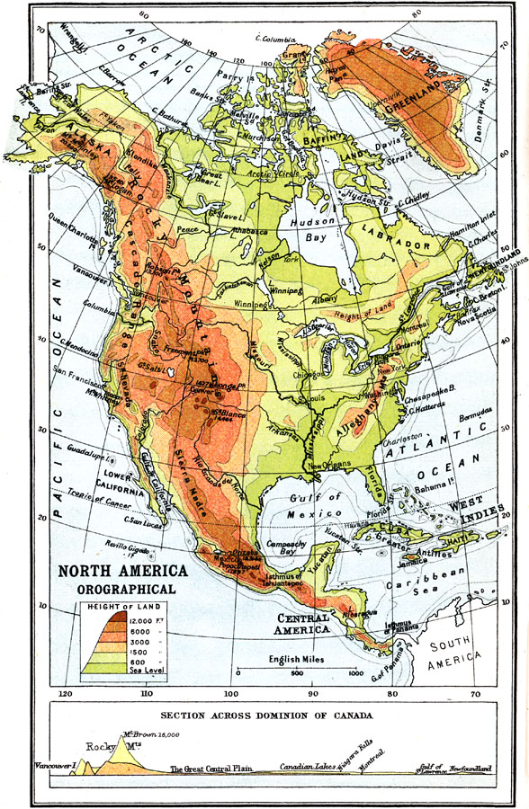
Description: A map from 1911 of North America, Central America, Greenland, and the Caribbean showing mountain systems (orographical), highlands, plains, and major rivers of the region. The map uses colot–contouring to show general land elevations from sea level to above 12,000 feet. The major mountain systems are named with prominent peaks shown with elevations given in feet above sea level. The submerged part of the continental plateau is shown by the fathom contour lines. A chart at the bottom of the map shows a cross–section vertical profile across the Dominion of Canada from Vancouver Island to Newfoundland.
Place Names: A Complete Map of North America, United States, �Mexico, �Cuba, �Canada, �Bahama
ISO Topic Categories: elevation
Keywords: Orographical map of North America, physical, kOrographic, topographical,
physical features, elevation, Unknown, 1911
Source: Ernest Rhys, Ed., A Literary and Historical Atlas of North & South America (New York, NY: E.P. Dutton & CO., 1911) 36
Map Credit: Courtesy the private collection of Roy Winkelman |
|