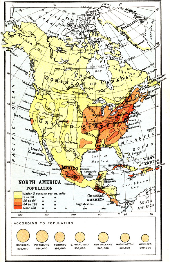
Description: A map from 1911 of North America, Central America, Greenland, and the Caribbean to Puerto Rico showing the population distribution at the time. The map is color–coded to show population densities from under 2 persons per square mile to areas of over 128 persons per square mile. A chart at the bottom of the map shows comparative city rankings based on population at the time for Montreal, Pittsburg, Toronto, San Francisco, New Orleans, Washington, and Winnipeg.
Place Names: A Complete Map of North America, Bahamas, �Canada, �Cuba, �Mexico, �United State
ISO Topic Categories: society
Keywords: North America, Population, statistical, �historical, kPopulation, population, society, Unknown, 1911
Source: Ernest Rhys, Ed., A Literary and Historical Atlas of North & South America (New York, NY: E.P. Dutton & CO., 1911) 39
Map Credit: Courtesy the private collection of Roy Winkelman |
|