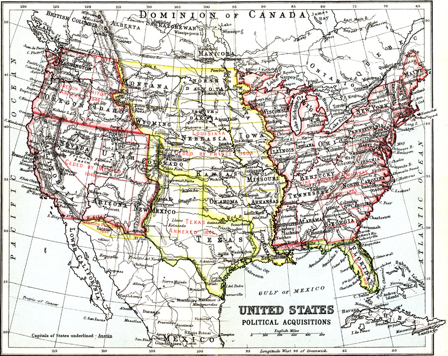
Description: A map from 1911 of the United States showing the territorial acquisitions from the original States and Northwest Territory in 1783 to the Gadsden Purchase south of the Gila River in 1853. The map shows state capitals and major cities, railroads, terrain features, and rivers.
Place Names: Growth of Nation, Washington D.C., �Seattle, �San Diego, �New York, �New Orleans, �Los Angeles, �Chicago, �Bosto
ISO Topic Categories: society
Keywords: Political Acquistitions of the United States, political, major political subdivisions, society, Unknown, 1911
Source: Ernest Rhys, Ed., A Literary and Historical Atlas of North & South America (New York, NY: E.P. Dutton & CO., 1911) 54
Map Credit: Courtesy the private collection of Roy Winkelman |
|