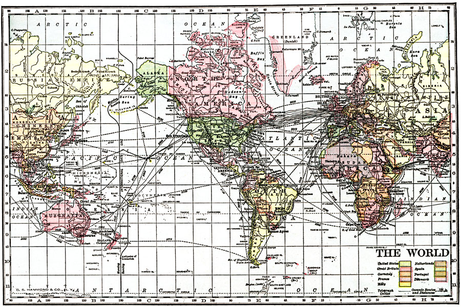
Description: A map of the world from 1912 showing telegraph cables, principal ocean routes with distances between ports given in nautical miles, and the colonies, territories, and possessions of the United States, Great Britain, Germany, France, Italy, Netherlands, Spain, Portugal, and Denmark.
Place Names: A Complete Map of Globes and Multi-continent, Africa, �Antarctica, �Asia, �Australia, �Europe, �North America, �Pacific Ocean, �South America, �Atlantic Ocean, �Indian Ocean, �Russian Empir
ISO Topic Categories: utilitiesCommunication,
transportation,
oceans,
inlandWaters,
boundaries
Keywords: Territories, Telegraph Cables, and Ocean Routes of the World, physical, �political, �transportation, �telegraph cables, physical features, country borders, water routes, utilitiesCommunication,
transportation,
oceans,
inlandWaters,
boundaries, Unknown, 1912
Source: The Manitoba Free Press, The Free Press Almanac Encyclopedia and Atlas (New York, NY: C. S. Hammond & Co., 1912) 97
Map Credit: Courtesy the private collection of Roy Winkelman |
|