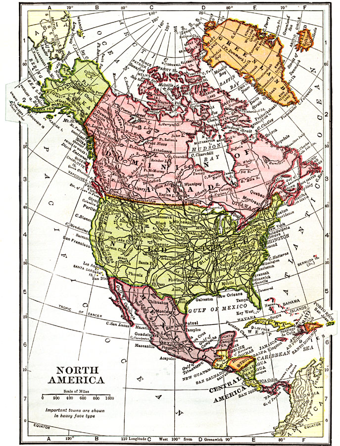
Description: A map from 1912 of North America, Central America, Greenland, and the Caribbean showing political boundaries at the time, capitals and major cities, railroads, mountain systems, lakes, rivers, and coastal features of the region.
Place Names: A Complete Map of North America, United States, �Mexico, �Cuba, �Bahamas, �Dominion of Canada, �Central America, �Gulf of Mexico, �Atlantic Ocean, �Pacific Ocean, ��Canad
ISO Topic Categories: boundaries,
inlandWaters,
oceans,
transportation
Keywords: North America, physical, �political, �transportation, physical features,
topographical, country borders, railroads, boundaries,
inlandWaters,
oceans,
transportation, Unknown, 1912
Source: The Manitoba Free Press, The Free Press Almanac Encyclopedia and Atlas (New York, NY: C. S. Hammond & Co., 1912) 103
Map Credit: Courtesy the private collection of Roy Winkelman |
|