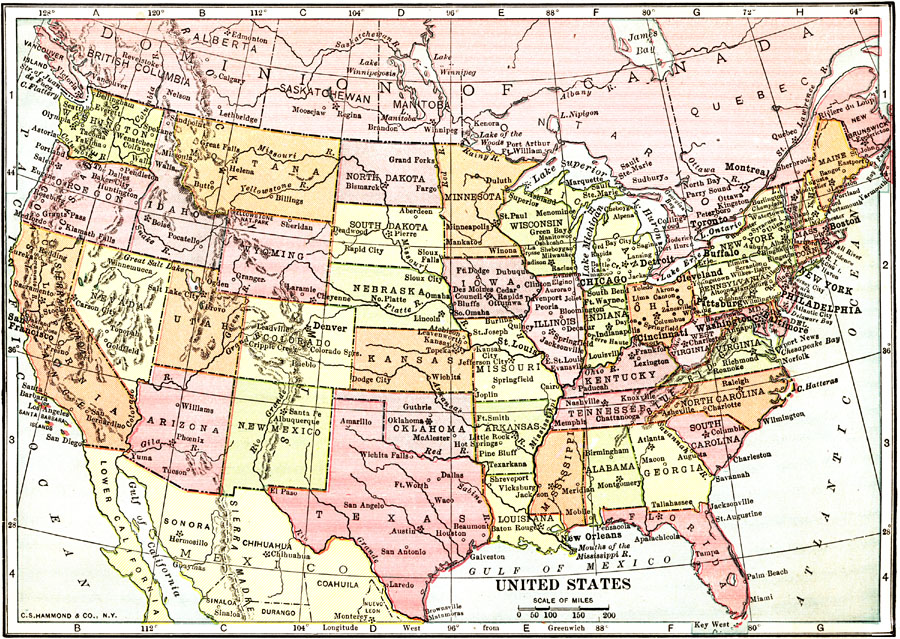
Description: A map from 1912 of the ‘lower forty–eight’ United States showing state boundaries and state capitals, major cities and towns, mountain systems, lakes, rivers, and coastal features.
Place Names: A Complete Map of the United States, Boston, �Chicago, �Houston, �Los Angeles, �Miami, �New Orleans, �New York, �San Diego, �Seattle, �Washington D.C., �San Francisco, �Philadelphi
ISO Topic Categories: boundaries,
inlandWaters,
oceans
Keywords: United States, physical, �political, physical features,
topographical, country borders,
major political subdivisions, boundaries,
inlandWaters,
oceans, Unknown, 1912
Source: The Manitoba Free Press, The Free Press Almanac Encyclopedia and Atlas (New York, NY: C. S. Hammond & Co., 1912) 104
Map Credit: Courtesy the private collection of Roy Winkelman |
|