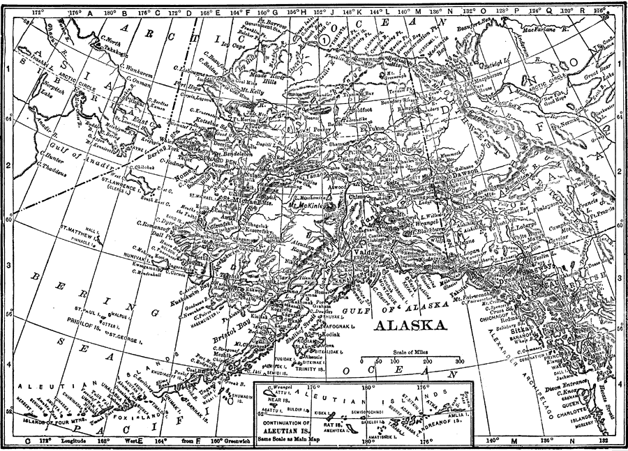
Description: A map of Alaska from 1912 showing the State capital at Juneau, cities, towns, ports, railroads, major rivers and mountains, coastal features, and islands. The map has an inset map of the western Aleutian Islands.
Place Names: Alaska, Kodiak, �Juneau, �Fairbanks, �Nome, �Gulf of Alaska, �Bering Sea, �Aleutian Island
ISO Topic Categories: boundaries,
inlandWaters,
transportation,
oceans
Keywords: Alaska, physical, �political, �transportation, physical features,
topographical, country borders,
major political subdivisions, railroads, boundaries,
inlandWaters,
transportation,
oceans, Unknown, 1912
Source: The Manitoba Free Press, The Free Press Almanac Encyclopedia and Atlas (New York, NY: C. S. Hammond & Co., 1912) 106
Map Credit: Courtesy the private collection of Roy Winkelman |
|