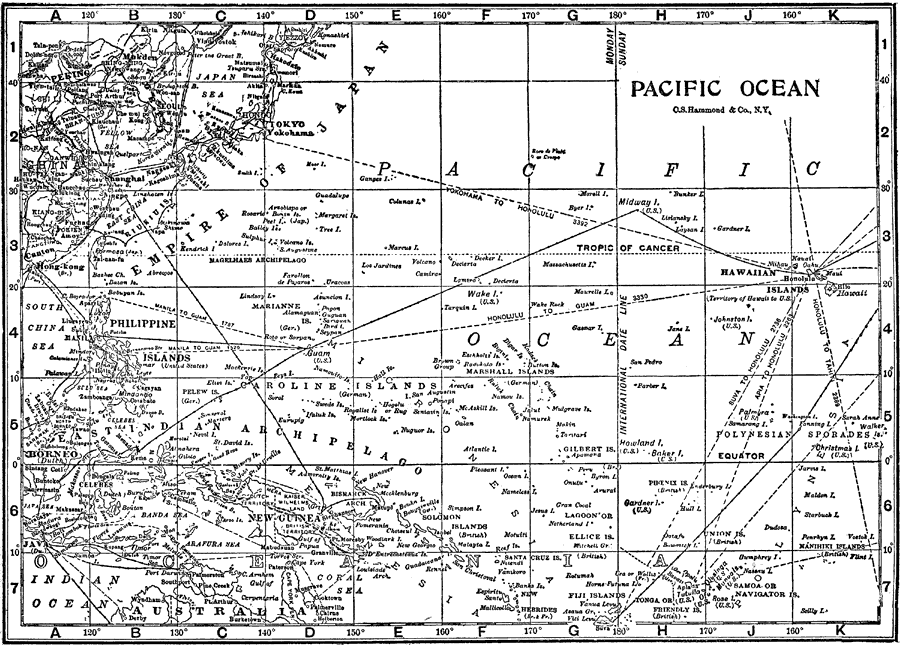
Description: Map of the western part of the Pacific Ocean with Borneo at the western part of the map, and the Hawaiian Islands at the eastern part. Shows the countries and islands that are along this side of the Pacific as well as major cities and water routes.
Place Names: Regional Pacific Ocean, Pacific Ocean, �Empire of Japan, �East Indian Archipelago, �Hawiian Islands, �New Guinea, �Borneo, �Fiji Islands, �Caroline Islands, �Polynesian Sporades, �Asia, �North Americ
ISO Topic Categories: physical, �political, �transportation, kWorldPacific
Keywords: Pacific Ocean, physical, �political, �transportation, physical features, country borders, water routes, physical, �political, �transportation, kWorldPacific, Unknown, 1912
Source: The Manitoba Free Press, The Free Press Almanac Encyclopedia and Atlas (New York, NY: C. S. Hammond & Co., 1912) 110
Map Credit: Courtesy the private collection of Roy Winkelman |
|