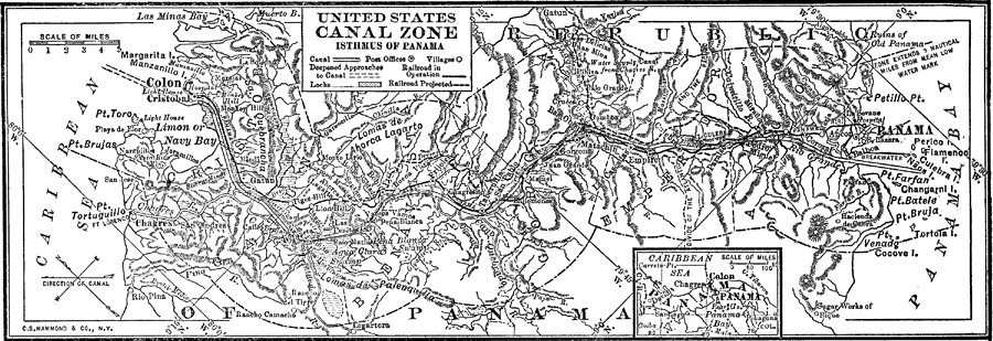
Description: A map from 1912 of the United States Canal Zone in Panama. The map shows the location of the canal, the deepened approaches to the canal, and the locks. The map also shows mountain ranges, railroads, projected railroads, post offices, and villages, and includes an insert map of the entire country of Panama with the canal indicated. Longitude and latitude lines are given to show the true orientation of the canal.
Place Names: Panama Canal Zone, Colon, �Cristobal, �Panama, �Panama Bay, �Panama Cana
ISO Topic Categories: inlandWaters,
oceans,
transportation
Keywords: United States Canal Zone Isthmus of Panama, transportation, �physical, �political, physical features,
topographical, country borders, railroads,
water routes, inlandWaters,
oceans,
transportation, Unknown, 1912
Source: The Manitoba Free Press, The Free Press Almanac Encyclopedia and Atlas (New York, NY: C. S. Hammond & Co., 1912) 111
Map Credit: Courtesy the private collection of Roy Winkelman |
|