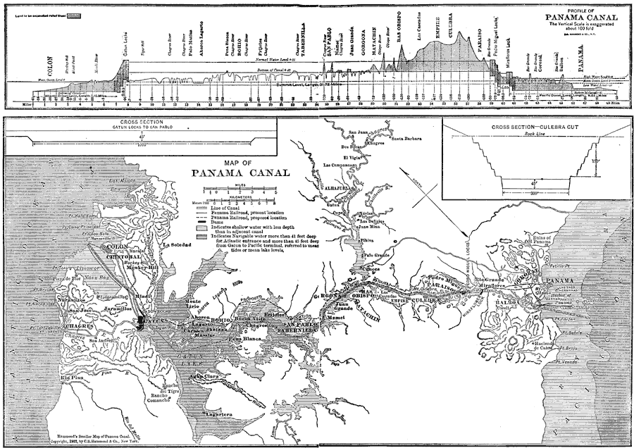
Description: A map from 1912 of the Panama Canal showing the line of the canal, areas of navigable water, and areas of shallow water that have less depth than the canal. This map also shows the location of cities, dams, the Panama Railroad, and the proposed location of the Panama Railroad. Included are insert maps of a cross section of the Gatun Locks to San Pablo and a cross section of the Culebra cut. A profile of the Panama Canal showing length, elevation, locks, and land to be excavated is also given.
Place Names: Panama Canal Zone, Colon, �Cristobal, �Panama, �Panama Canal, �Gatun Lake,
ISO Topic Categories: inlandWaters,
transportation,
oceans
Keywords: Panama Canal, physical, �transportation, physical features, railroads,
water routes, inlandWaters,
transportation,
oceans, Unknown, 1912
Source: The Manitoba Free Press, The Free Press Almanac Encyclopedia and Atlas (New York, NY: C. S. Hammond & Co., 1912) 112
Map Credit: Courtesy the private collection of Roy Winkelman |
|