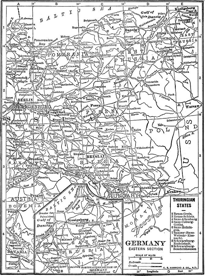
Description: A black–and–white map of the eastern section of Germany in 1912. The map shows Prussia east of Berlin up to Konigsberg on the Baltic Sea and extending down into Silesia. Portions of the German territories of Saxony, Mecklenburg, and Bavaria are shown, as well as portions of Poland and Austria. Major cities, railroads, and rivers are shown, as well as a reference key to the Thuringian States and an inset map showing the area around Konigsberg.
Place Names: Germany, Berlin, �Dresden, �Baltic Sea,
ISO Topic Categories: boundaries,
inlandWaters,
transportation
Keywords: Germany Eastern Section, physical, �political, �transportation, physical features, country borders,
major political subdivisions, railroads,
water routes, boundaries,
inlandWaters,
transportation, Unknown, 1912
Source: The Manitoba Free Press, The Free Press Almanac Encyclopedia and Atlas (New York, NY: C. S. Hammond & Co., 1912) 118
Map Credit: Courtesy the private collection of Roy Winkelman |
|