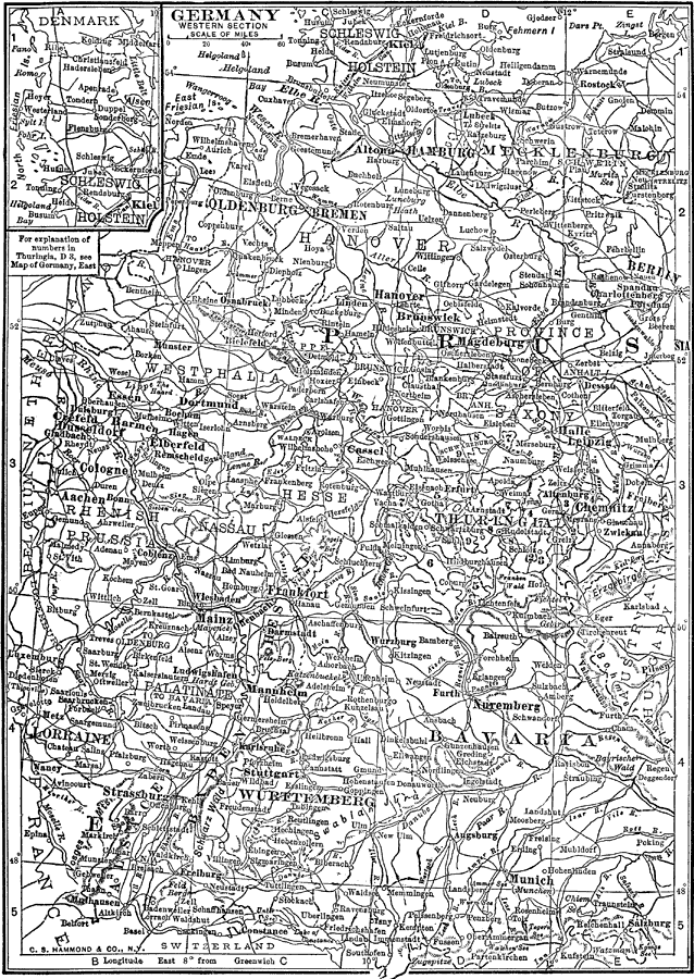
Description: A black–and–white map showing the western section of Germany and its subdivisions in 1912. The map shows the individual states west of Berlin, and major cities, railroads, and rivers of the country. The map also shows the Alsace and Lorraine territories taken from France in 1871, and includes an inset map of Schleswig–Holstein.
Place Names: Germany, Hamburg, �Nuremberg, �Cologne, �Munich,
ISO Topic Categories: boundaries,
transportation,
oceans,
inlandWaters
Keywords: Germany Western Section, physical, �political, �transportation, physical features, country borders,
major political subdivisions, railroads,
water routes, boundaries,
transportation,
oceans,
inlandWaters, Unknown, 1912
Source: The Manitoba Free Press, The Free Press Almanac Encyclopedia and Atlas (New York, NY: C. S. Hammond & Co., 1912) 119
Map Credit: Courtesy the private collection of Roy Winkelman |
|