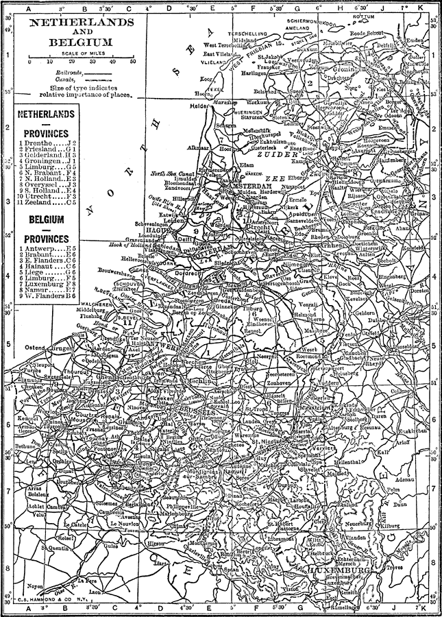
Description: A map of the Netherlands, Belgium, and Luxemburg in 1912, showing cities, waterways, mountain ranges, canals, and railroads. The map also shows the provinces of both the Netherlands and Belgium.
Place Names: Low Countries, Netherlands, �Belgium, �North Sea, �Zuider Zee, �Luxembur
ISO Topic Categories: boundaries,
inlandWaters,
transportation
Keywords: Netherlands and Belgium, physical, �political, �transportation, physical features,
topographical, country borders,
major political subdivisions, railroads,
water routes, boundaries,
inlandWaters,
transportation, Unknown, 1912
Source: The Manitoba Free Press, The Free Press Almanac Encyclopedia and Atlas (New York, NY: C. S. Hammond & Co., 1912) 121
Map Credit: Courtesy the private collection of Roy Winkelman |
|