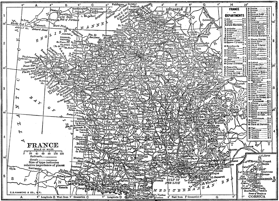
Description: A map of France showing cities, waterways, mountain ranges, railroads, and canals in 1912. France's Departments are referenced and indicated on the map. An insert map of Corsica is also included.
Place Names: France, Bordeaux, �Paris, �Bay of Biscay, �English Channel, �Mediterranean Sea, �Corsic
ISO Topic Categories: boundaries,
inlandWaters,
oceans,
transportation
Keywords: France, physical, �political, �transportation, physical features,
topographical, country borders,
local jurisdictions, railroads,
water routes, boundaries,
inlandWaters,
oceans,
transportation, Unknown, 1912
Source: The Manitoba Free Press, The Free Press Almanac Encyclopedia and Atlas (New York, NY: C. S. Hammond & Co., 1912) 122
Map Credit: Courtesy the private collection of Roy Winkelman |
|