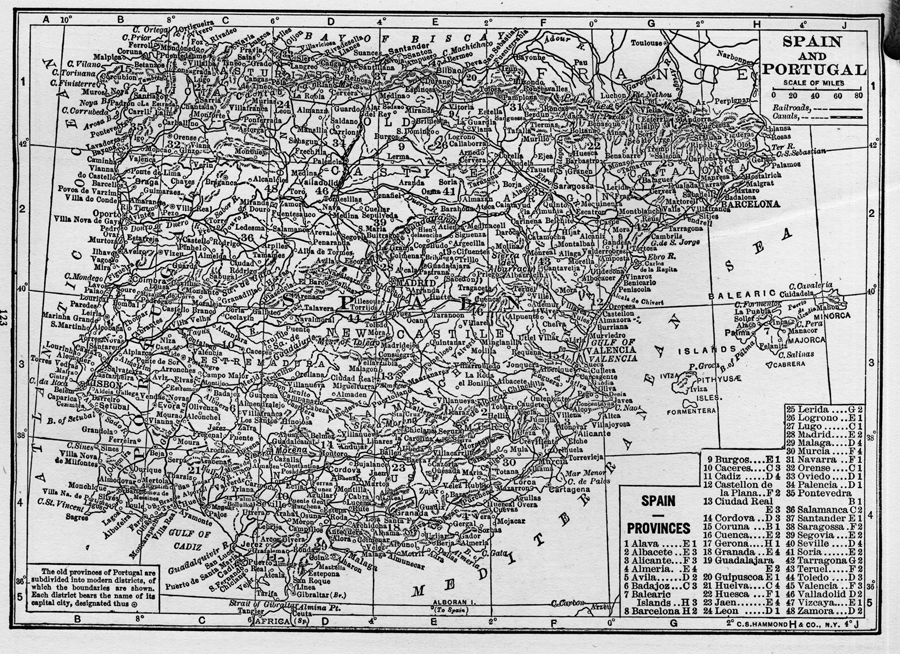
Description: A map from 1912 of Spain and Portugal showing cities, waterways, mountain ranges, railroads and canals. Spain's provinces and Portugal's districts are also indicated on the map.
Place Names: Iberian Peninsula, Barcelona, �Madrid, �Portugal, �Spain, �Lisbo
ISO Topic Categories: boundaries,
oceans,
inlandWaters,
transportation
Keywords: Spain and Portugal, physical, �political, �transportation, physical features,
topographical, country borders,
major political subdivisions, railroads,
water routes, boundaries,
oceans,
inlandWaters,
transportation, Unknown, 1912
Source: The Manitoba Free Press, The Free Press Almanac Encyclopedia and Atlas (New York, NY: C. S. Hammond & Co., 1912) 123
Map Credit: Courtesy the private collection of Roy Winkelman |
|